
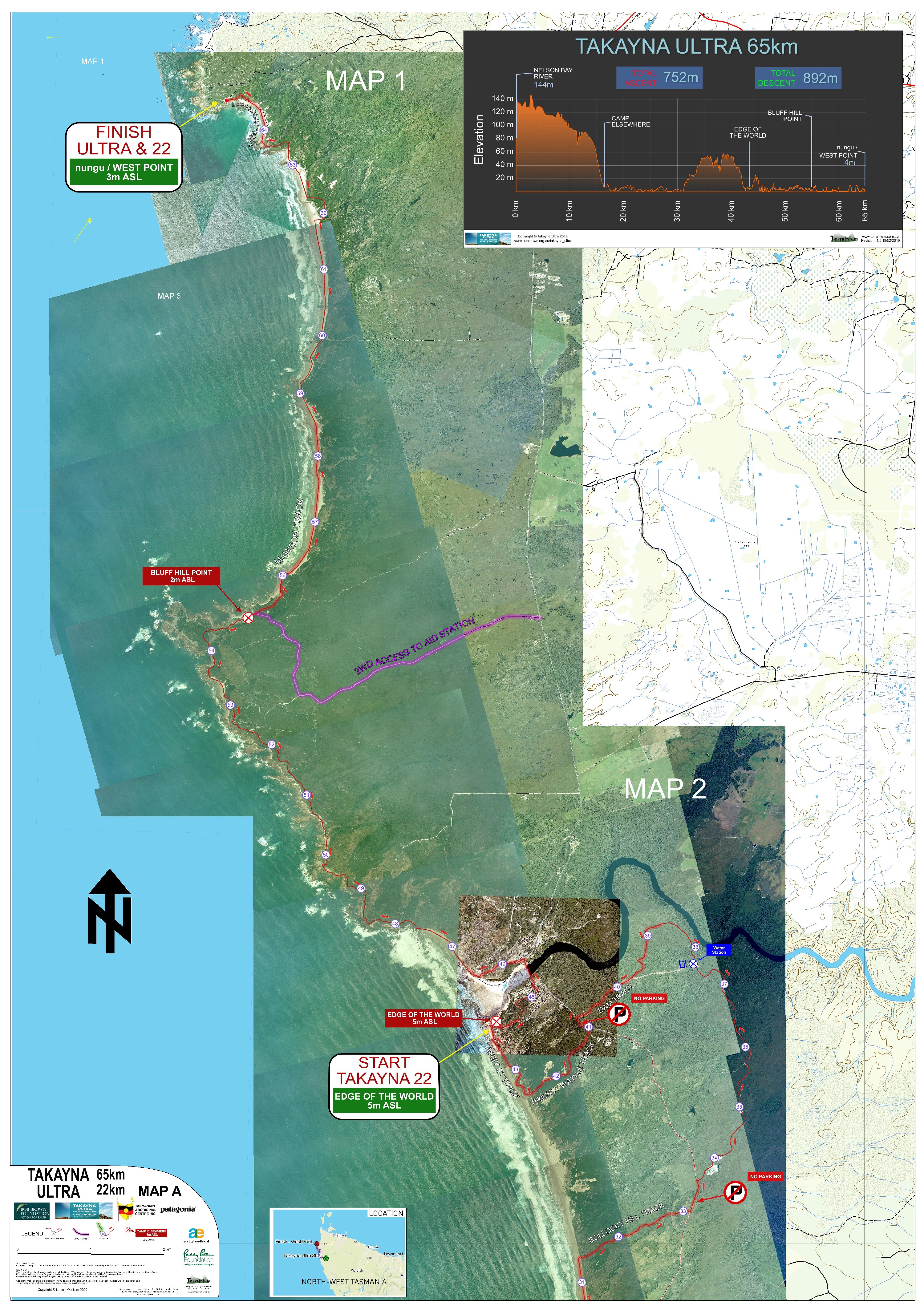
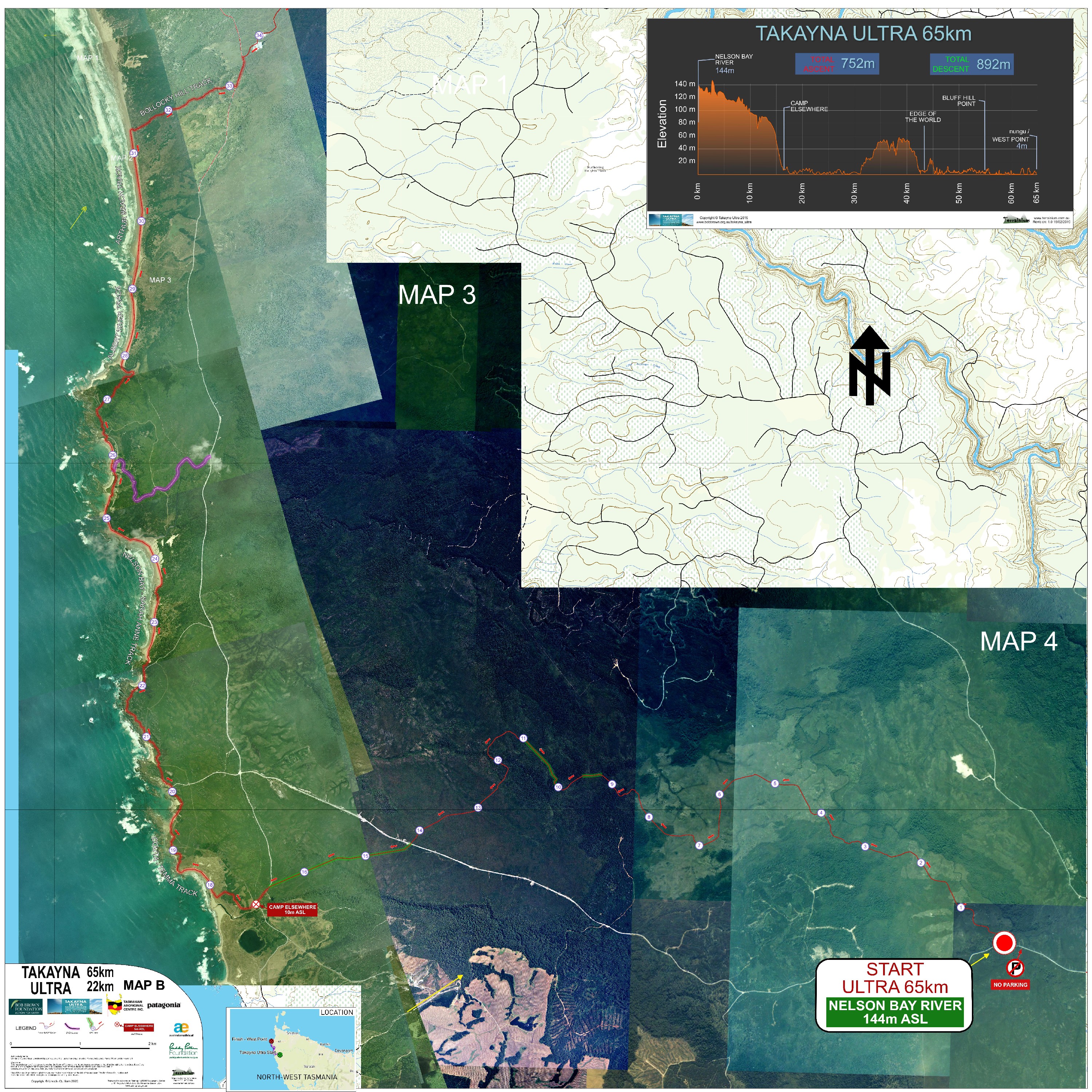
Takayna Ultra 65 and Takayna 22 Event Map
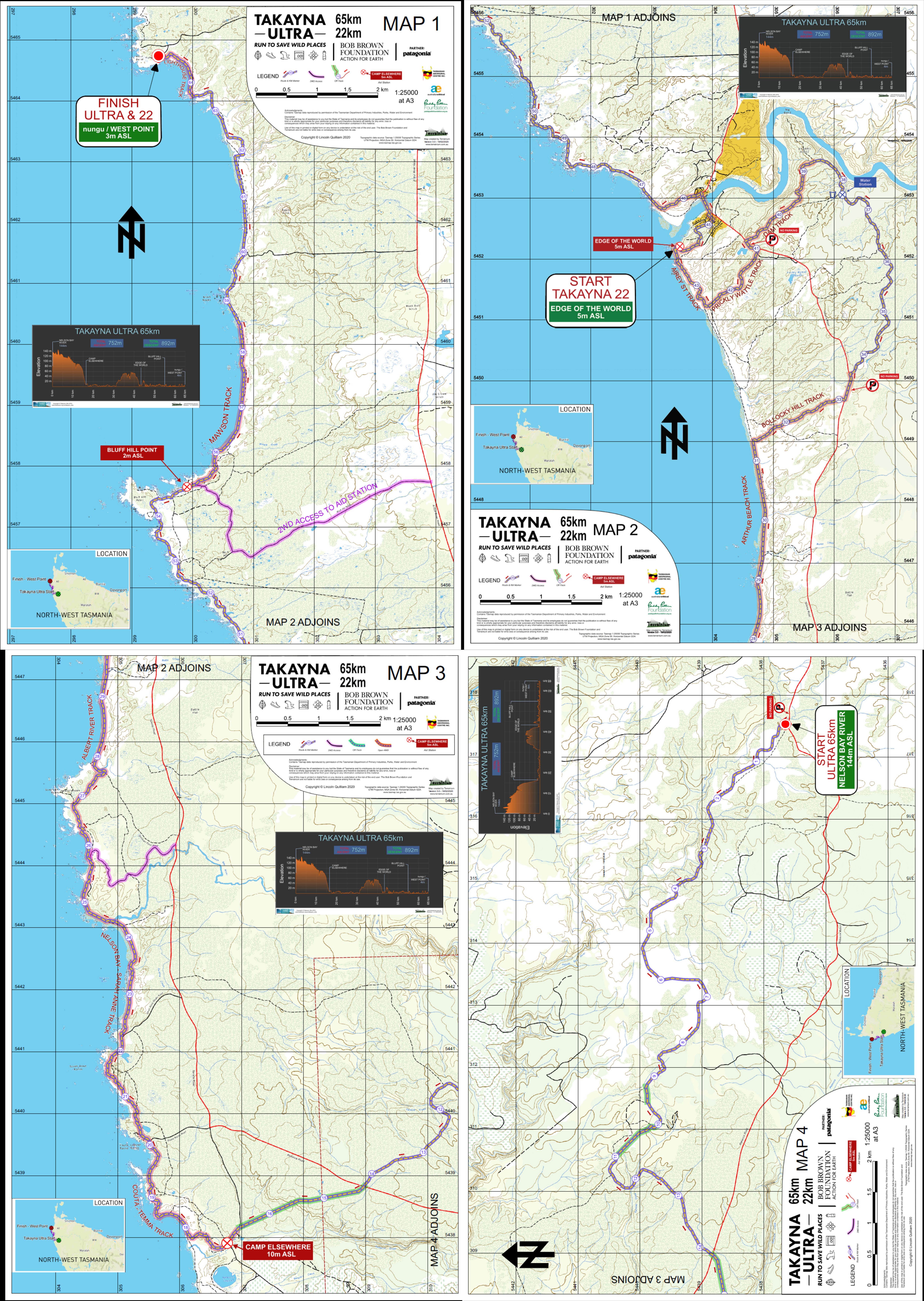
Starting beside the dark brown buttongrass tannin-stained Nelson Bay River, the run immerses you immediately in rolling native grass plains and stands of dry eucalypt forest. Open beaches, dunes, and impressive low rocky sections, and more dark rivers and creeks to cross, are dispersed occasionally with fishing shack settlements and extensive Aboriginal heritage.
Disclaimer:
These maps may be of assistance to you there is no guarantee that the data is without flaw of any kind or is wholly appropriate for your particular purposes. The Bob Brown Foundation, Terrainium and the Tasmanian Department of Primary Industries, Parks, Water and Environment disclaim all liability for any error, loss or consequences which may arise from your relying on any information contained in this material. Downloading these maps indicates your agreement to these terms.
Acknowledgments:
Contains base map information from The Tasmanian Department of Primary Industries, Parks, Water and Environment and Mapbox Route information has been derived from original various runner GPX files and Google Earth.
EXPLORE THE ROUTE
How to get the TAKAYNA ULTRA map for your smartphone
- You don’t need to be in phone coverage to use the map – it’s loaded on your phone and can be use when you’re offline.
- You will need to have Avenza Maps installed on your phone or device. Get it here Avenza Maps
- To use the maps on your smartphone, you will need to establish an Avenza Maps account. This is free and you won’t be charged for this map. You can establish the account on the Map Store checkout when you get to that stage.
- The maps are downloaded to your phone and approximately 300MB of storage is required to load and display each map.
- Click on the download link and you’ll be redirected to the Avenza Map Store where you can view a sample of the map and download it directly to your phone or device.
- Select the Get this Map button, then select the Free button to start the download.
- For best viewing of the aerial image, enable High Resolution in Avenza Maps BEFORE you load the map:
- Iphone (IOS) – go to Settings>General and select the option “Always use High Resolution”
- Android – go to Settings>General and select the option “PDF Resolution on Import” then select “300 dpi”
TAKAYNA 65 PROFILE
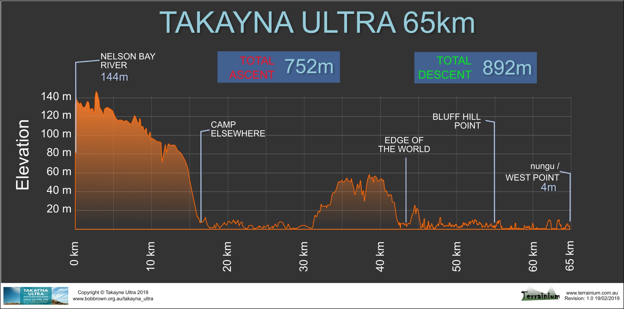
Click for larger image
DOWNLOAD THE ROUTE GPX FILE
![]()