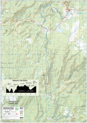
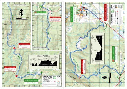
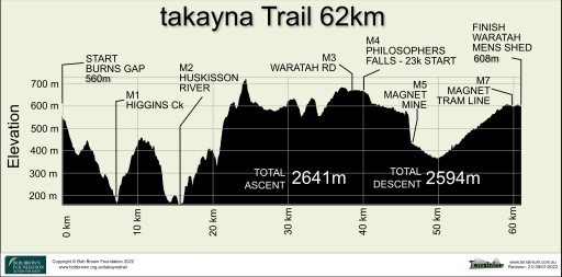
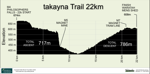
[Updated 19/02/2022]
The event maps are available for use on a smartphone using the Avenza Maps app. It runs on Android or iOS (iPhones & iPads) and lets you display the event map in detail and see exactly where you are on it.
You don’t need to be within mobile phone range to use the map as it’s stored locally.
This will be invaluable in an emergency or if you are just unsure of your location on the course
Disclaimer:
These maps may be of assistance to you there is no guarantee that the data is without flaw of any kind or is wholly appropriate for your particular purposes. The Bob Brown Foundation, Terrainium and the Tasmanian Department of Primary Industries, Parks, Water and Environment disclaim all liability for any error, loss or consequences which may arise from your relying on any information contained in this material. Downloading these maps indicates your agreement to these terms.
Acknowledgments:
Contains base map information from The Tasmanian Department of Primary Industries, Parks, Water and Environment and Mapbox. Route information has been derived from original runner GPX files and Google Earth.
Event Maps
 Loading the Avenza Maps app and the takayna Trails Event Maps
The event map is FREE to download for use on a smartphone using the Avenza Maps app. The app is available for your smartphones and lets you display the event route in detail and see your exact location on the route. This will be invaluable to support your training activity prior to course marking and importantly provide your precise coordinate and relative track location in an emergency.
The map is stored locally on your phone and can be used offline when not in mobile phone range or when you are conserving battery in aeroplane mode.
To load the map, scan the QR code on your phone (or just tap it if you are reading this page on your phone) and the Avenza app will open and load the map. If you don’t have Avenza installed, you will be directed to the appropriate app store to install it, after which the map load will complete.
For additional instructions on loading and using Avenza maps, see the Terrainium Support Page .
The event route is embedded in the map and is shown as a dashed line with direction arrows and km markers. There is no need to download any additional files to show the route. NOTE The map files can be quite large (up to 100MB), so you’ll need sufficient storage on your phone to accommodate it.
When the map is displayed, you can pan around by dragging your finger over the screen and zoom in or out by pinching or expanding your fingers on the screen. To go to where you are on the map, press the target circle on the top left (Android) or the arrow pointer (bottom left for iPhone or top right for iPad)
Troubleshooting
- If you don’t see your location (and you know that you are within the bounds of the map), your GPS is probably not turned on for the application. Here’s how to fix it:
- On iOS (iPhone, iPad), go to Settings>Privacy>LocationServices then on the list of apps, make sure that Avenza Maps has the “Always” setting enabled.
- On Android, make sure that Location Services are enabled.
- Check out the support page. You may have missed something.
- If all else fails and you need assistance to install Avenza Maps or loading the maps, please send a quick email to Graham Field and include a contact phone number.
![]()


